Mount Aragats and Kari Lake: When the Road Opens
24 September 2026
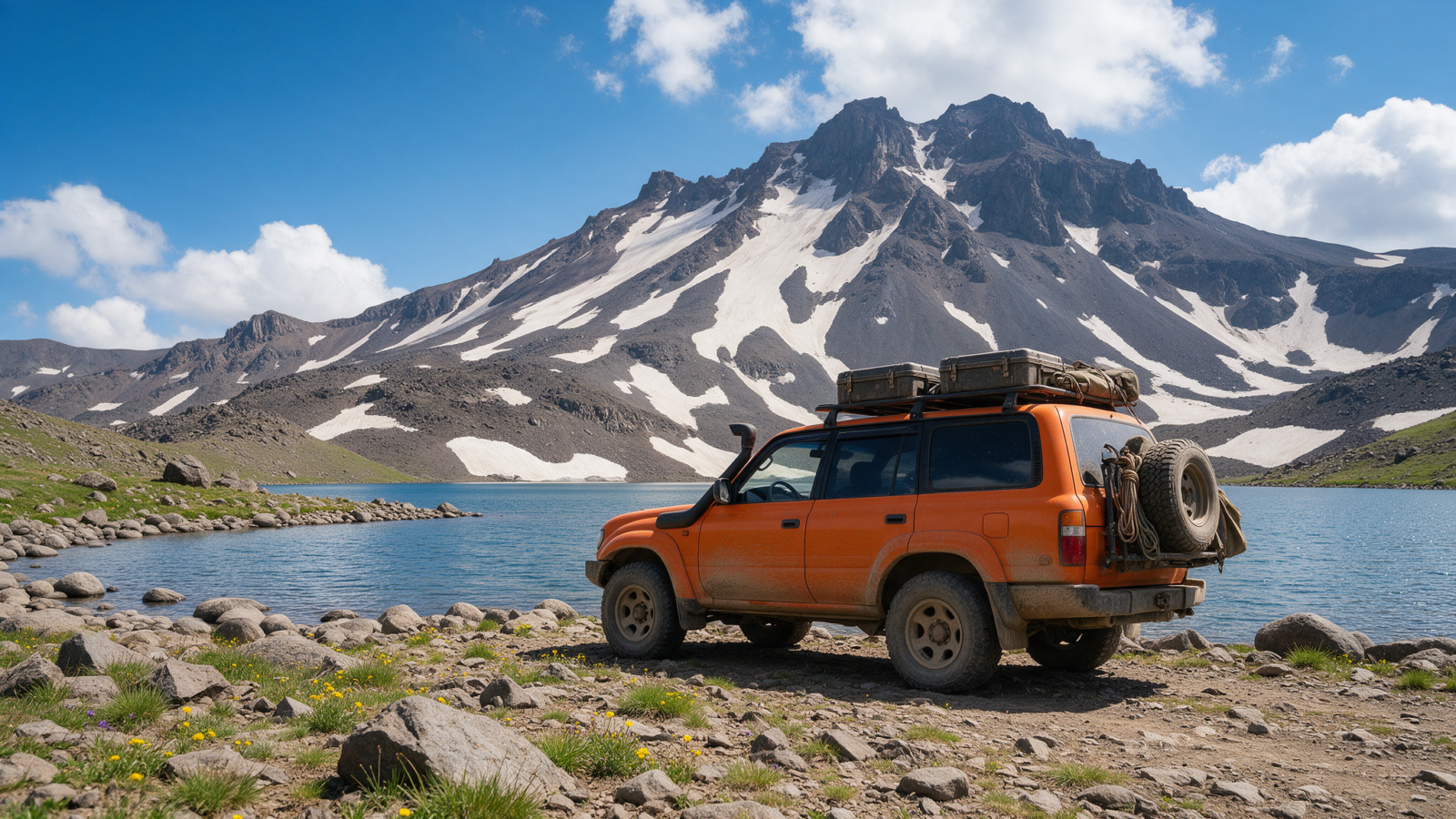
The road to Kari Lake, on the slopes of Mount Aragats, is closed from late November to mid-May — that’s the fact that actually decides whether this trip is possible, more than any question about the car. Outside that window, it’s a full day out from Yerevan: through Byurakan, up to Amberd fortress at 2,300 metres, then on to the lake itself at 3,200. Plan the day around the season first, the vehicle second.
The route: Byurakan, Amberd, Kari Lake
Byurakan is the last village before the road climbs in earnest — also home to Armenia’s astrophysical observatory, worth a glance if you’re passing through, though it’s a separate visit from the drive up the mountain. From there the road climbs steadily to Amberd, then continues higher to the lake.
| Leg | Distance | Plan for |
|---|---|---|
| Yerevan → Amberd | 43 km | 1 h 15 – 1 h 30 |
| Amberd → Kari Lake | 24 km | 40–60 min |
| Yerevan → Kari Lake, total | 67 km | 2 h – 2 h 30, one way |
That’s a genuine day trip, not a quick detour — count on the better part of a day once you include both stops and the drive back down. There’s nothing to rush here: the elevation gain from Yerevan’s roughly 1,000 metres to the lake’s 3,200 is itself a reason to take the day slowly rather than treat it as a there-and-back errand.
There is no fuel available on the road above Byurakan. Fill up in Ashtarak or before you leave Yerevan — this stretch is one of the specific gaps worth treating as having nothing available at all, the same way we flag the Selim Pass and the Vorotan stretch.
Amberd fortress, a destination in its own right
Amberd sits at 2,300 metres, and it’s worth treating as more than a rest stop on the way to the lake. It’s an early medieval fortress, expanded over the centuries by the noble families who held it, with a church built into the same site — walls and towers set on a dramatic spur between two ravines, with Aragats rising behind. Admission is 1,500 AMD for tourists, and it’s open 09:00–20:00. Most visitors give it 45 minutes to an hour, more if the weather is clear enough to enjoy the views down the gorge.
Kari Lake and the road above it
Above Amberd, the road continues to Kari Lake at 3,200 metres, with Aragats’ north peak — 4,090 metres — rising behind it. We’ve covered the surface question in detail elsewhere: sources disagree about the final stretch, and our guide to 4×4 needs in Armenia sets out our position, which is that the road is paved and sedan-drivable in dry summer conditions, and that weather rather than surface is the real constraint. We won’t re-litigate that here — the short version is that the car matters less than the calendar.
Snow patches persist near the lake into July most years, even once the road itself is open, so don’t expect a fully green, snow-free scene the moment the closure lifts. The altitude is worth taking seriously regardless of season: mild headache and breathlessness are common on the climb from Yerevan and are nothing to worry about, but they’re a reason to take the last stretch slowly and skip any hard hike the same afternoon you arrive.
When to go
The road is closed from late November to mid-May — a long closure, not a token gesture, and there’s no partial or early-opening exception to plan around. That leaves roughly six months of access, and within that window the edges matter. Late May and late October are the shoulder weeks either side of the closure: the road is open, but conditions at 3,200 metres can still turn with little warning, and a sudden snowfall this early or late in the season is entirely normal rather than exceptional.
There’s a second layer worth knowing honestly rather than smoothing over: regional guidance points to July through September as the more settled window for Aragats specifically, even though the access road itself opens in mid-May. We won’t pretend those two windows perfectly agree — the road being open is not the same as the mountain being at its most reliable, and if your dates are flexible, July to September is the safer bet for calm weather at altitude.
Aragats sits far enough from Armenia’s other main clusters that it usually works best as a dedicated day rather than something bolted onto a longer loop. If you’re mapping it against the rest of a trip, our self-drive itinerary guide covers where a day like this fits alongside Yerevan, Gyumri and the north.
Aragats and Kari Lake, at a glance
- Road closedLate November – mid-May
- Amberd altitude / admission2,300 m, 1,500 AMD, 09:00–20:00
- Kari Lake altitude3,200 m
- FuelNone above Byurakan — fill up before you leave
- Steadiest windowJuly–September, once the road is open
- Car neededSedan fine in dry summer conditions — see our 4×4 guide
Planning Aragats around your actual dates?
Tell us when you’ll be in Armenia and we’ll tell you honestly whether the road is likely to be open, and what shoulder-season margin to plan for.
Questions people actually ask
When does the road to Kari Lake open?
It’s closed from late November to mid-May and reopens for a practical season running from mid or late May through to late October, with snow patches near the lake often lasting into July. See winter driving in Armenia for how this fits alongside Armenia’s other seasonal closures.
Do I need a 4×4 for Kari Lake?
Not for the surface — the road is paved and a sedan manages it in dry summer conditions. The case for a higher car is weather margin in the shoulder weeks, not the road itself. Full answer in our 4×4 guide.
What is there to see at Amberd?
An early medieval fortress and church at 2,300 metres, set on a spur between two ravines with Aragats rising behind it. Admission is 1,500 AMD, open 09:00–20:00. Most visitors spend 45 minutes to an hour there before continuing up to the lake.
How long does the Aragats day trip take?
Budget roughly 2 to 2.5 hours of driving each way from Yerevan to Kari Lake, plus time at Amberd and the lake itself. Treat it as a full day rather than a half-day add-on.
Is there fuel on the way up to Kari Lake?
No. There’s nothing available on the road above Byurakan, so fill up in Ashtarak or before leaving Yerevan.
Will I feel the altitude at Kari Lake?
Quite possibly. You climb from around 1,000 metres in Yerevan to 3,200 at the lake in a little over two hours, and mild headache or breathlessness is common and normal. Take the last stretch slowly and don’t plan a hard hike the same afternoon.
What’s the single best time to go?
July to September, once the road has been open for a while and conditions at altitude tend to be at their most settled. Late May and late October also work, but as shoulder weeks right against the closure dates, with less margin if the weather turns.
Last verified 25 September 2026. Distances are routed on the OpenStreetMap network; drive times are reconciled planning figures rather than machine estimates. Amberd admission and hours are current published figures; road closure dates come from Armenian Rescue Service bulletins.