The Selim Pass and the Vardenyats Caravanserai
24 September 2026
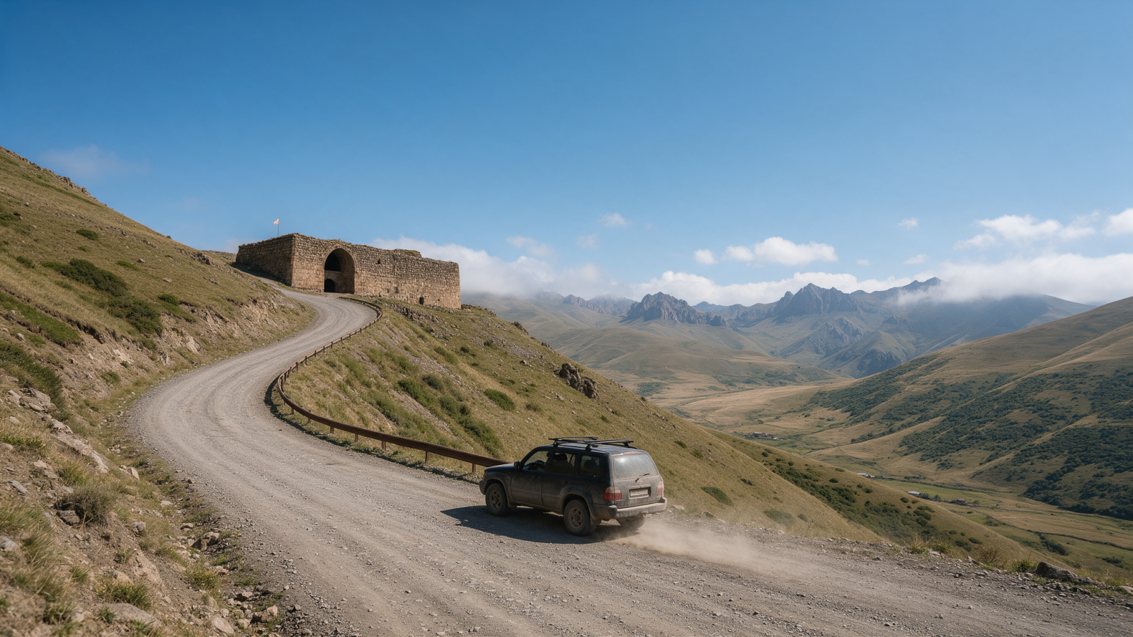
The Selim, or Vardenyats, Pass tops out at 2,410 metres between the wine country of Vayots Dzor and the south shore of Lake Sevan, and in summer and the shoulder seasons it’s a perfectly ordinary drive — paved the whole way, rough in places, no different in spirit from any other mountain road in Armenia. The reason to actually stop here, rather than just cross it, is sitting right at the summit: the Selim caravanserai, built in 1332, one of the best-preserved Silk Road waystations left in the Caucasus.
The pass itself
At 2,410 metres, Selim is one of the higher passes on the regular tourist map, and the road matches the altitude — fully paved but badly broken in stretches, the kind of surface that punishes speed rather than clearance. It’s a suspension road, not a sedan-versus-SUV question. Driven slowly in summer, any rental car manages it without drama, a point we cover in more depth in our guide to when a 4×4 is actually worth it in Armenia.
The pass connects two very different parts of Armenia. On the south side, Yeghegnadzor sits at the edge of Vayots Dzor’s wine country, close to Areni and Noravank. On the north side, the road drops down toward Martuni on Lake Sevan’s southern shore. It’s a genuinely useful link, not just a scenic diversion — it’s how you get from the Areni wine region to the lake without backtracking through Yerevan.
| Leg | Distance | Plan for |
|---|---|---|
| Yeghegnadzor → Selim caravanserai | 35 km | 45–55 min |
| Selim caravanserai → Martuni | 26 km | 35–45 min |
The Vardenyats caravanserai
The caravanserai itself was built in 1332, a long stone hall with a vaulted roof designed to shelter travelling merchants, their animals and their goods overnight on the route across the mountains. It sits right at the summit of the pass, which is unusual — most caravanserais were built lower down, closer to villages, so a structure this old still standing at 2,410 metres says something about how much traffic this crossing carried centuries ago.
We couldn’t find a published entrance fee or official opening hours for the site, and that’s consistent with how these buildings have generally been left — there’s no ticket booth and no gate. You park, walk in, and look around. If that changes, it will be recent, so don’t be surprised either way.
No services, in any season
There is nothing on the Selim Pass itself — no fuel, no café, no shelter beyond the caravanserai’s stone walls. That’s true whether you’re crossing in July or January. Fill up in Yeghegnadzor before you start the climb from the south, or in Martuni if you’re coming from the Sevan side. Treating mountain passes as having no services at all, and fuelling up in the last real town rather than the next one, is the same rule that applies on the Aragats road and through the Debed canyon — see winter driving in Armenia for where else it matters.
Don’t start the climb to Selim on a low tank in either direction. The nearest reliable stations are in Yeghegnadzor to the south and Martuni to the north — nothing exists in between.
Winter is a different question
This article is about the pass in good weather — summer and the shoulder months either side of it. Winter changes the calculation enough that it deserves its own answer rather than a short paragraph here: Rescue Service bulletins usually list Selim as restricted for articulated trucks and difficult for other vehicles, rather than fully closed, though it does shut outright in severe weather. For the full winter picture, including how that compares to Armenia’s other high passes and the legal winter-tyre requirement, see our dedicated winter driving guide.
Where this fits a route
Selim works best as a link rather than a there-and-back trip. Coming from Yerevan, a natural day combines it with Khor Virap, Areni and Noravank on the way out, crossing Selim afterward and coming back via Lake Sevan rather than retracing the same road. It’s also a good addition to a wider loop — our self-drive itinerary guide covers how to sequence a route like this without doubling back on yourself.
Selim Pass, at a glance
- Altitude2,410 m
- Road surfacePaved, rough in places — drive slowly, any sedan manages it
- CaravanseraiBuilt 1332, free to walk into, no published hours
- Services on the passNone — fuel in Yeghegnadzor or Martuni first
- WinterUsually restricted for trucks rather than closed — see our winter guide
Crossing Selim as part of a bigger loop?
Tell us which side of the pass you’re starting from and we’ll tell you how it fits with Areni, Noravank and Sevan on the same trip.
Questions people actually ask
How high is the Selim Pass?
2,410 metres, the same figure that applies across our winter and 4×4 guides. It’s one of the higher passes on Armenia’s regular tourist routes.
Is the Vardenyats caravanserai open to visit?
Yes, and there’s no ticket booth. We found no published entrance fee or official hours — it’s a stone hall you can walk into and look around, built in 1332.
Can I drive the Selim Pass in a normal rental car?
Yes, in summer and the shoulder seasons. The road is fully paved but rough in stretches, which is a reason to drive slowly rather than a reason to need a 4×4. See when a 4×4 is actually worth it in Armenia.
Is the Selim Pass closed in winter?
Usually restricted rather than fully closed — Rescue Service bulletins typically show it closed to articulated trucks and difficult for other vehicles, with full closures only in severe weather. See winter driving in Armenia for the complete picture and where to check conditions before you travel.
What’s on either side of the pass?
The south side drops into Vayots Dzor near Yeghegnadzor, close to Areni and Noravank. The north side descends to Martuni on Lake Sevan’s southern shore — a natural link between the two regions without backtracking through Yerevan.
Where should I fuel up before crossing?
Yeghegnadzor if you’re heading north, or Martuni if you’re heading south. There is nothing on the pass itself in either direction.
How long does crossing Selim take?
Yeghegnadzor to the caravanserai is 35 km, 45–55 minutes. From the caravanserai down to Martuni is a further 26 km, 35–45 minutes. Add stopping time at the caravanserai itself, which most people find worth ten or fifteen minutes.
Last verified 25 September 2026. Distances are routed on the OpenStreetMap network; drive times are reconciled planning figures rather than machine estimates, assuming a mountain average of 50–60 km/h. Winter road-condition notes come from Armenian Rescue Service bulletins.